A walk round 1640 Uxbridge
Mid-17th century Uxbridge mainly comprised the High Street and The Lynch, with many inns, flour mills, and a market house just east of the present building. From 1642, Uxbridge was a Parliamentary garrison, probably fortified along the River Colne and the High Bridge.
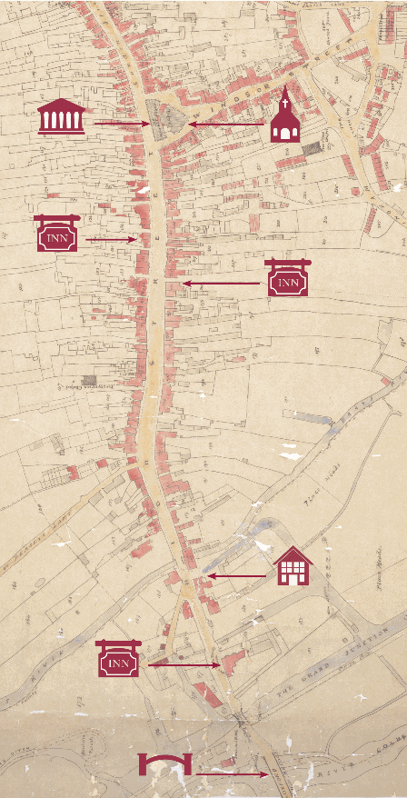
The rough location of the original market building; today's Market House was built in 1788.
St Margaret's Chapel, where Puritan preacher Christopher Love gave a market day sermon against the Treaty.
The rough location of the George Inn, the headquarters of the Parliamentary commissioners.
The rough location of the Crown Inn, the headquarters of the Royalist commissioners The Crown.
Fountains Mill, in whose walls a local man hid his savings during the troubles. The coins were rediscovered in 1895.
The Crown and Treaty public house, previously The Place or Place House - site of the Treaty negotiations.
The High Bridge over the River Colne.